Trip Report: Mt Whitney
Introduction
Back in April, my buddy Mark texted me:
"Do you think Mt Whitney around June 14 would be too snowy? There are permits available."
Thus sparked an idea. Mark was finishing up his residency in Cincinnati, and with some time between residency and fellowship, he was looking for an adventure. Originally, he had scored a JMT permit out of Tuolomne Meadows, but had to abandon that dream to the Sierra's record snowpack.
Over the next couple weeks, we texted back and forth. Mostly Mark asking questions and expressing uncertainty about all the snow, while I optimistically lied through my teeth and encouraged him to give it a shot. I hadn't originally planned on hiking Whitney with him, but when he was wavering mid-May on attempting it at all, I promised to guide him. "I can't guarantee I'll get you to the summit, but I'll make sure you don't die." That was enough to get Mark to book a plane ticket to Reno.
Prep
He arrived on a Tuesday while I was working. Short on sleep and coming from 400 feet above sea level, Mark went out for a short hike in the Reno foothills and reported that "he definitely felt the elevation." We did the obligatory WinCo shopping trip that night to load up on snacks from the bulk section, no doubt getting more food than we would need.
Wednesday was a travel day, and we loaded up the car mid-morning and began the trip down 395. Always scenic, it was particularly good this time of year as the snow was still so prevalent. I played the role of tour guide, pointing out landmarks like the Sawtooths, Mono Lake, and Mount Tom as we rolled down the east side. We stopped in Bishop to pick up mountaineering boot rentals. The bulky, heavy boots weren't my first choice, but we really didn't know what conditions would be like and I figured it was better to have boots and crampons in case we needed them.
We arrived at the Whitney Portal Campground sometime after 5:00 PM. It was warm, not too buggy, and after tinkering with our gear we laid down to try and get some rest. A little after sunset, a thunderstorm brought heavy rain and thunder to the campground. It was calming to listen to, though I had a hard time going to sleep due to anxious energy for the day ahead.
The Hike | 2023-06-15
"It's just a dayhike," we told each other to downplay the difficulty. When alarms went off at 1:30 AM, it was go time. We quickly drove up to the trailhead and a couple minutes before 2:00 AM were on the trail.
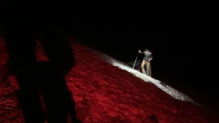
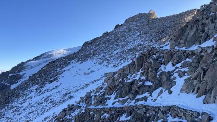
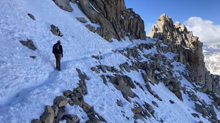
Mark traversing avalanche debris via headlamp.
As lead sherpa, my job was to navigate us through the darkness, over avalanche debris, and across snowfields toward the summit. With just a sliver of a waning crescent moon in the sky, it was dark in the canyon and I quickly took a wrong turn on an avalanche field less than a quarter of a mile from the trailhead. It took maybe 5 minutes to get us back on track, and I told myself, "you're going to have to do better than that if we're making it to the summit." Fortunately, I was able to channel my inner bloodhound from that point and I think we only got turned around one more time during the remaining 3 hours of headlamp hiking.
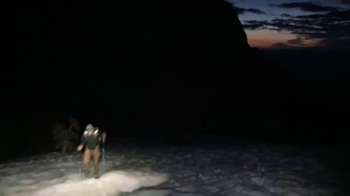
About two miles in, somewhere around benchmark 9,544, the trail turned into a snowfield. We slipped on microspikes over our trail runners and continued steadily along. We were making good time, and our goal of reaching Trail Camp by sunrise seemed feasible.
Shortly after, I noticed headlamps traveling up the south side of the canyon from Outpost Camp, away from Mirror Lake. In fact, the majority of footprints in the snow seemed to head that way, despite the fact that the summer trail hooks north toward Mirror Lake. After a quick pow-wow, Mark and I decided to cross the meadow and stick with the summer trail. It may have been a bit circuitous, but the grade stayed mellow, and we didn't have any trouble with water crossings. I would not have wanted to sidestep a steep slope in the dark. I think this ended up being a fine decision, because we caught up to those headlamps before Consultation Lake.
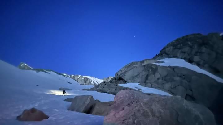
Above 11,000 feet, you enter an Alpine environment and the trail mellows in grade. Instead of picking our way through forests and slabs, we slogged up endless snow. Looking back toward Lone Pine, we saw a splash of golden orange on the horizon as the pre-dawn sun shown first light. We postholed infrequently, but even once was enough to know that the snow hadn't fully frozen the night before. Best to keep moving and make as much progress as possible before the sun turned the snow to slush.
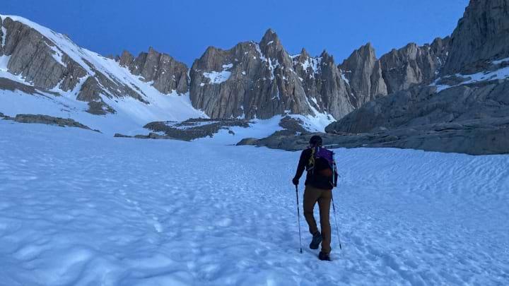
We passed Trail Camp just before sunrise, both feeling in high spirits. Thus far, our shoes and microspikes had been sufficient, neither of us felt the effects of altitude, and the sky looked clear. There were thunderstorms and 4 inches of snow in the forecast for the afternoon, so we wanted to get up and down as quickly as possible. The "99 switchbacks" were buried under snow, so most people had been ascending the snowfield to climber's right. We marched up to the base, probably around 12,400 feet, and took a 10-minute break to eat a snack, put on sunscreen, and swap out trekking poles for ice axe. Judging by all the postholes present in the snow, we decided to stick with trail runners and microspikes, leaving the burlier boots and crampons in our packs.
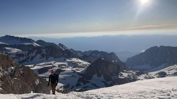
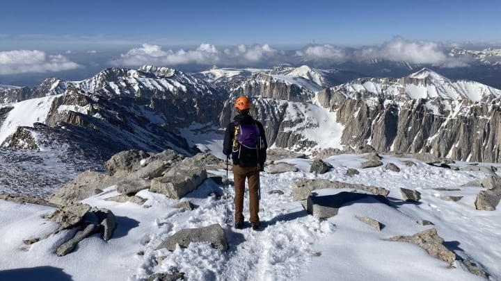
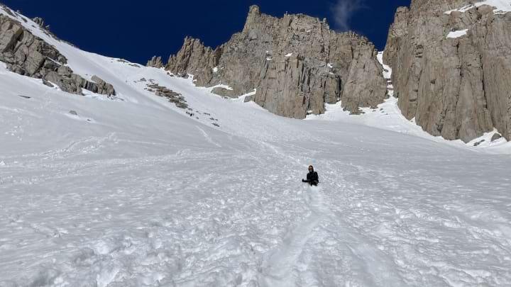
Ascending the snowfield up to Trail Crest was probably the most difficult portion of the entire hike. With the sun now up, it quickly grew hot, and we were sweating as we labored to put one foot above the other. I think it took us a little under an hour to get from the base to the crest, and we were both relieved to touch granite and take a break on flat ground. We were rewarded with gorgeous views west toward Crabtree Meadows and the Great Western Divide. So much snow!
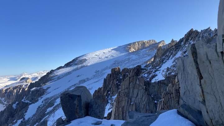
Looking up at the snowfield we would climb. Picture appears flatter than reality.
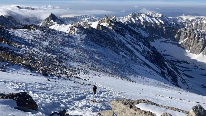
Mark about halfway up the snowfield.
Mark reaching the top of the snowfield.
The trail from Trail Crest to Keeler Needle was mostly snow covered due to recent storms over the past weekend. We kept the microspikes on, but swapped out the axe for trekking poles. We would only need the axe again for short stint on the final push to the summit. It was shaping up to be a beautiful morning with good visibility and no wind, perhaps the warmest I've ever experienced on Whitney. I was impressed with Mark, who kept a great pace despite being 14,000 feet higher than what his body is used to. The short night we spent acclimating at the campground must have done some good.
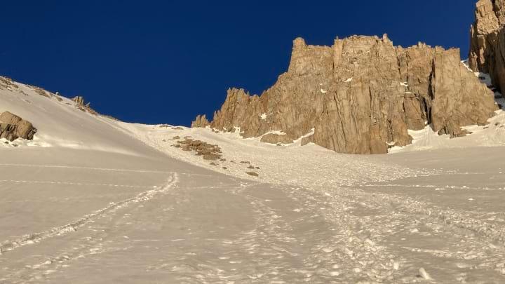
Still plenty of snow on the trail along the crest.
Ascending the final climb to Whitney.
All snow until the very top.
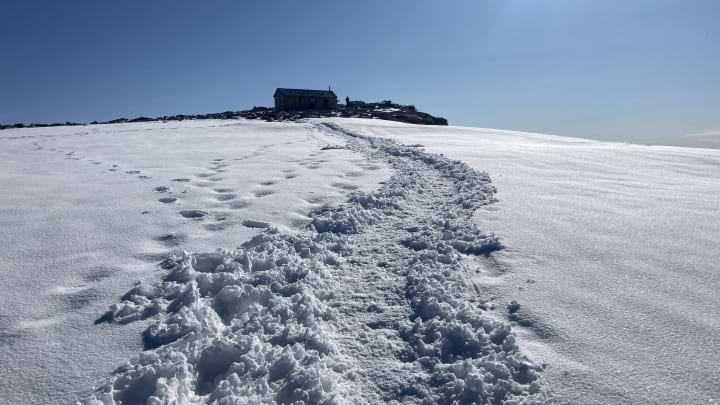
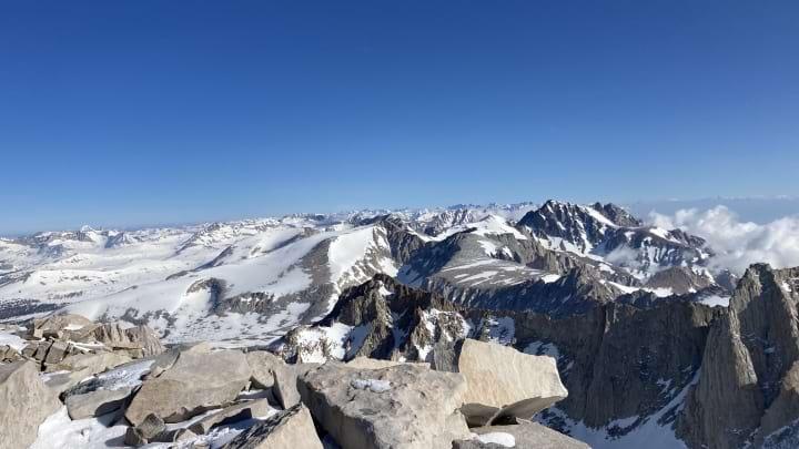
We summited around 8:00 AM, almost exactly six hours from the start. Pictures, snacks, water, and a quick FaceTime with Mark's mom—all the usual festivities. Table Mountain loomed off in the distance, and to the far north I think I picked out North Palisade. The Sierras look like it's mid-February, not June! Absolutely insane how much snow there was up there.
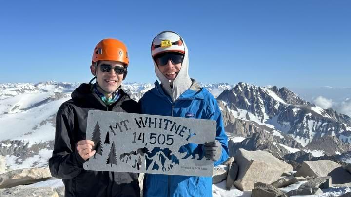
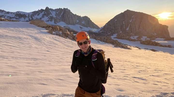
Qué guapo!
The sky was friendly, but we knew we were only halfway done so by 8:30 AM we set back out on the return trip. We cruised along the ridge back to Trail Crest, where six or so people were all taking breaks having just gotten up the big snowfield. It seems like many people struggled with this section, or at least it ate up a lot of time, because there were probably another ten or so folks bootpacking up the snowfield while we descended. Mark got his first experience in glissading ("It's nice when it's smooth, but kind of hurts!"). The snow had softened considerably over the past 4 hours, so we slid down on our butts and self-arrested periodically to slow our speed. I think that was the longest glissade I've ever done—longer than Forrester Pass had been on the PCT. We took a big sigh of relief at the bottom, as arriving back at Trail Camp meant we were through the most dangerous and technical sections. All that was left to do was a long, posthole-filled, slog to the bottom.
Another shot at the snow along the crest, this time on our way back.
Mark's first glissade. A success!
And slog we did. We retraced our steps, stopping only a couple times to reapply sunscreen or grab some more water. At times, you could kind of skate/ski with your heals to pick up some free distance, but much of the time our feet just sank through the snow. Fortunately, coverage was so good that I was never really worried about hitting rocks underneath. I imagine the postholing only got more miserable for the groups behind us, as it was already quite soft by 11:00 AM. This part of a hike is never the fun one, just a necessity between the summit and the bar reminiscing. We mostly walked in our thoughts, still enjoying the gorgeous winter wonderland around us.
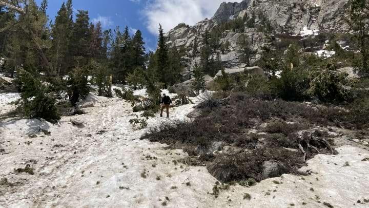
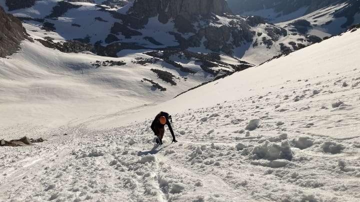
Meandering back down soft snow and avalance debris.
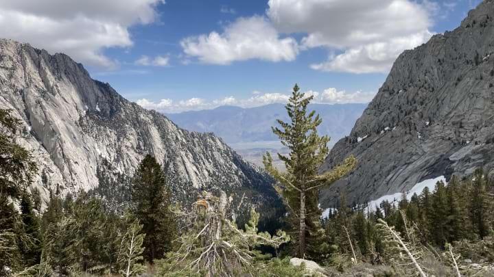
A little before 1:00 PM, we crossed the avalanche field a quarter mile from the trailhead, now a straightforward affair in the sunlight compared to the disorienting mess it had been at 2:00 AM. The total trip had been 11 hours, including our 30 minute break at the top, which far exceeded any expectation either of us had had. We celebrated with burgers and fries from the portal store, before beginning the drive back home. What an epic day!